
|
After a disaster, aid workers and relief organizations primarily need usable maps of the affected region in order to be able to provide humanitarian aid and to find their way around on the ground, since the workers are usually not from the area but operate worldwide. If a disaster occurs in an area in need of stabilization, often only simple maps exist on which important elements such as technical infrastructure.
In the following are some maps, satalites or cartographies wich are illustrating the current crisis situation in the Euphrates and Tigris area. [TR/SY/IQ]
|
Map; Cartography: Earth Quake in Kurdish Area
Kurdistan is one of the most earthquake affected areas in the Middle East. Due to the subduction zone that extends across Kurdistan, earthquakes occur repeatedly because the Arabian plate presses against the Eurasian plate.
The quakes are often at shallow depths, which limits their propagation but increases their intensity.
One explanation for high earthquake risk in this area can be found in the collision of the continental plates of Africa, Europe and Arabia.
|
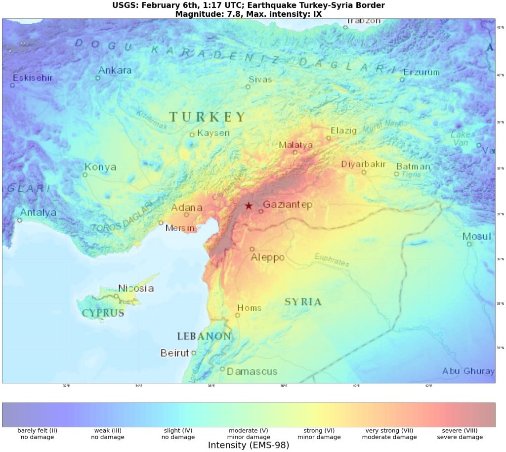
Current earthquake in the region
FEB 2023 – at the Turkey-Syria Border
2 subsequent earthquakes above magnitude 7,8 [firstone:Kahramanmaras/Pazarcik] and 7,5 [secondone: Kahramanmaras/Elbistan] and further aftershocks – shook the region at the Turkey-Syria Border in Southeast Turkey and Northwest Syria. The outmas of this earthquakes on Feb 6th 2023 has failed intensively in this region.
The earthquake was inevitable but the scale of the disaster was not. Due to unstable disaster protection architecture and lack of stable civil society organizations is the management of the crisis very limited.
According to local organizations – both the Turkish state and the Syrian region do not tolerate kurdish aid organizations and there is further political discrimination in humanitarian aid landscape.
A new era of crisis and crisis managing facing the region with humanitarian aid crisis and material scarcities.
In the following stallite images shows the extent of the earthquake near the epicenter. Kahramanmaras bevor and after the earthquake:
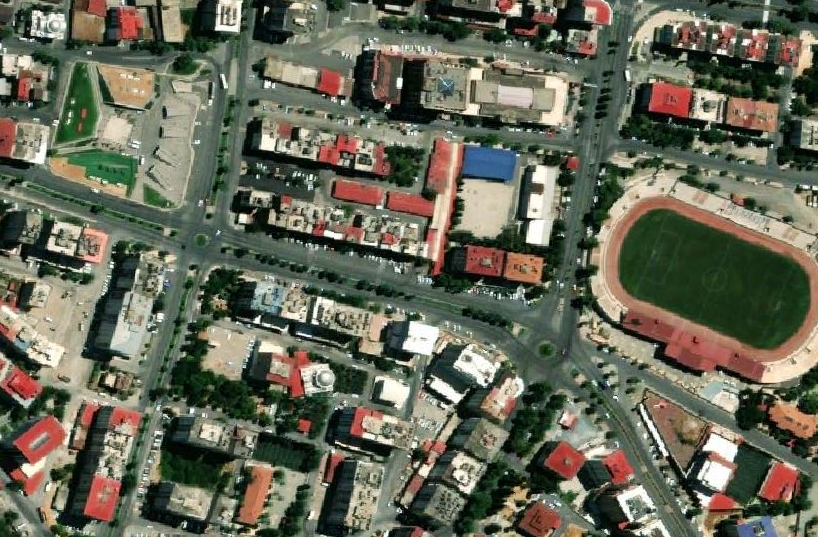
– MARAS bevor the earthquake |2023 –
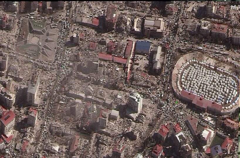
– MARAS after the earthquake |2023 –
North-West-Syria
Especially North-West-Syria is strongly affected.
The impact area of the earthquake is because of previously existing unstable factors due to the ongoing war and restrictions.
|

|
MAP: COVID-19 IN THE MIDDLE EAST
|
This Map is a regional overview and shows a bi-weekly growth rate of the Pandemie. [For the rate please click on the countries in the map.]
(Data source: John Hopkins University)
Publications SARS‐CoV‐2 Pandemic:
– Merkes, Sara T.; Güven, Şermin; Voss, Martin (2021). Democratic Disaster Risk Management and Pandemic Control: Socio‐Political Debates on Civil Liberties during the SARS‐CoV‐2 Pandemic with
Examples from Armenia and Germany. AKFS Report Nr. 10. Berlin: AKFS.
– Güven, Şermin (2021) „IMPACTS and escalating RISKS of the Covid-19 pandemic“. Online: https://coronainc.a-kfs.de/covid-19-escalating-risks/